Our Pride Athmallik
GoAthmallik.wap.sh
| http://GoAthmallik.wap.sh
| | | | | |
| | | | ______________________________ | Site Under Maintainance.. Latest Comming Soon |
Location:-
Location of Athmallik in Orissa and India Coordinates 20°43′N 84°32′E.
Country-India
State-Orissa
District(s)-Angul.
Population 11,383 (2001)
Time zone IST (UTC+05:30) Area • Elevation • 67 metres (220 ft)
Athmallik(Oriya: language) is a town and a notified area committee in Anugul district in the state of Orissa, India.
| _______________ | Situated At:-
Athmallik is located at 20.72°N 84.53°E.[2] It has an average elevation of 67 m (220 ft). It is a
very cool and nice place. Athmalik
is part of Kosal. People of this
sub-division identify themselve
with Western Oriya people.
Athmalik is under Sambalpur University's jurisdiction.As of 2001 India census,[3] Athmallik had a population of
11,383. Males constitute 52% of
the population and females 48%.
Athmallik has an average literacy
rate of 65%, higher than the
national average of 59.5%; with 59% of the males and 41% of
females literate. 13% of the
population is under 6 years of
age. presently very atrractive
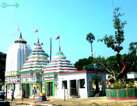
plecess to see in maa binikei godes.
| _______________ | Distance To Other Place:-
Athmallik is one of the Town in Athmallik Tehsil in Anugul
District in Orissa State . Athmallik is 59.4 km far from its District Main City Anugul .
It is 146 km far from its State Main City Bhubaneswar . Near By Villages of this Village with distance are
Kudagaon(5.9 k.m.) ,
Aida(7.4 k.m.) ,
Lunahandi (15.9 k.m.)
,Maimura(17.2 k.m.) ,
Sanjamura(18 k.m.) ,.
Nearest Towns are
Athmallik(0 k.m.) ,
Kishorenagar(23.3 k.m.) ,
Chhendipada(41.1 k.m.) ,
Angul(60.1 k.m.) ,
|
www.GoAthmallik.wap.sh.......www.GoAthmallik.wap.sh.......www.GoAthmallik.wap.sh.......www.GoAthmallik.wap.sh.......www.GoAthmallik.wap.sh..............
|
|---|
|
|---|
|
|---|